Category:Fenwick, East Ayrshire
Jump to navigation
Jump to search
village in East Ayrshire, Scotland, UK | |||||
| Upload media | |||||
| Instance of | |||||
|---|---|---|---|---|---|
| Location |
| ||||
| Population |
| ||||
 | |||||

Subcategories
This category has the following 7 subcategories, out of 7 total.
B
- Bruntland Bridge (8 F)
C
- Craufurdland Loch (5 F)
K
- Fenwick Kirk (81 F)
P
R
- Rigghill Farm (3 F)
W
- Whitelee Wind Farm (120 F)
Media in category "Fenwick, East Ayrshire"
The following 45 files are in this category, out of 45 total.
-
 B778 from Fenwick to Stewarton - geograph.org.uk - 264783.jpg 640 × 480; 169 KB
-
 Bend on A77 at North Drumboy - geograph.org.uk - 635325.jpg 525 × 640; 91 KB
-
 Blair Farm, Stewarton - geograph.org.uk - 725646.jpg 640 × 480; 86 KB
-
 Derelict cottage - geograph.org.uk - 1236344.jpg 640 × 480; 98 KB
-
 Donkey Paddock - geograph.org.uk - 264883.jpg 640 × 436; 107 KB
-
 Farm Road - geograph.org.uk - 265075.jpg 640 × 480; 104 KB
-
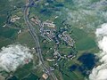 Fenwick from the air (geograph 5019764).jpg 640 × 480; 140 KB
-
 Fenwick Hotel - geograph.org.uk - 264874.jpg 640 × 480; 116 KB
-
 Fenwick Lorry Park - geograph.org.uk - 264865.jpg 640 × 431; 54 KB
-
 Fenwick Parish Church, East Ayrshire - Guard's post.jpg 4,426 × 3,200; 5.56 MB
-
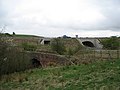 Four Bridges - geograph.org.uk - 405019.jpg 640 × 480; 75 KB
-
 Gardrum - geograph.org.uk - 265088.jpg 640 × 480; 77 KB
-
 Gardrum House - geograph.org.uk - 264781.jpg 640 × 475; 78 KB
-
 Glaister Bridge - geograph.org.uk - 257187.jpg 640 × 449; 135 KB
-
 Glenleitch Farm - geograph.org.uk - 264855.jpg 640 × 478; 88 KB
-
 Gree Law - geograph.org.uk - 404057.jpg 640 × 480; 86 KB
-
 Harelaw Farm, Stewarton - geograph.org.uk - 725657.jpg 640 × 480; 63 KB
-
 High Gainford Farm - geograph.org.uk - 264789.jpg 640 × 448; 63 KB
-
 High Todhill Farm - geograph.org.uk - 264847.jpg 640 × 436; 63 KB
-
 John Fulton Memorial Hall, Fenwick.JPG 2,288 × 1,712; 2.06 MB
-
 Junction of the M77 and A77 - geograph.org.uk - 259320.jpg 640 × 480; 40 KB
-
 Kings Arms, Fenwick - geograph.org.uk - 264892.jpg 640 × 462; 58 KB
-
 Laigh Fenwick - geograph.org.uk - 264889.jpg 640 × 476; 105 KB
-
 Laigh Fenwick - geograph.org.uk - 276536.jpg 640 × 468; 155 KB
-
 Livery sign. - geograph.org.uk - 265099.jpg 640 × 480; 88 KB
-
 Map of Fenwick. 1829. Robert Aitken.jpg 4,896 × 2,752; 2.03 MB
-
 Midton - geograph.org.uk - 404933.jpg 640 × 480; 62 KB
-
 Minor road to Tannacreiff - geograph.org.uk - 264792.jpg 640 × 480; 118 KB
-
 Moorland Between A77 and M77 - geograph.org.uk - 635421.jpg 640 × 480; 190 KB
-
 North Drumboy Farm - geograph.org.uk - 1499850.jpg 640 × 480; 84 KB
-
 Old and new - geograph.org.uk - 690415.jpg 640 × 480; 76 KB
-
 Porisken Farm - geograph.org.uk - 264840.jpg 640 × 461; 75 KB
-
 Raithburn Farm - geograph.org.uk - 259312.jpg 640 × 480; 43 KB
-
 Raithhill Farm and A77 - geograph.org.uk - 276535.jpg 640 × 426; 127 KB
-

-

-
 Road to Townend farm - geograph.org.uk - 404928.jpg 480 × 640; 120 KB
-
 Tannacrieff Farm - geograph.org.uk - 265065.jpg 640 × 480; 83 KB
-
 Tannacrieff road - geograph.org.uk - 265061.jpg 480 × 640; 103 KB
-
 Townend farm - geograph.org.uk - 404939.jpg 640 × 480; 61 KB
-
 Townhead of Gree - geograph.org.uk - 259300.jpg 640 × 480; 71 KB
-
 Track to South Glassock - geograph.org.uk - 1149259.jpg 404 × 640; 146 KB
-
 West Tannacrieff Farmhouse - geograph.org.uk - 264795.jpg 640 × 463; 81 KB
-
 Wind Turbine at South Drumboy Farm - geograph.org.uk - 81535.jpg 640 × 480; 74 KB
-
 Wyllieland Farm - geograph.org.uk - 276533.jpg 640 × 426; 121 KB


.jpg)


